Happy Accident
At the time of this writing, September 2019, construction of the new Stockholm Royal Seaport (Norra Djurgårdsstaden
) housing development is of course far from finished, but it is remarkable how the buildings that have already been completed along the waterfront at Husarviken, adjacent to the Hjorthagen district, just north of Stockholm’s inner city, how these buildings are primarily characterized by how creative
the facade materials, color schemes, window patterns, and balcony solutions often are. And no building looks like any of its neighbors.
Personally, I find all this in-your-face creativity,
all this competition between architects to create a unique look for each and every building, personally I find all this artificial variation
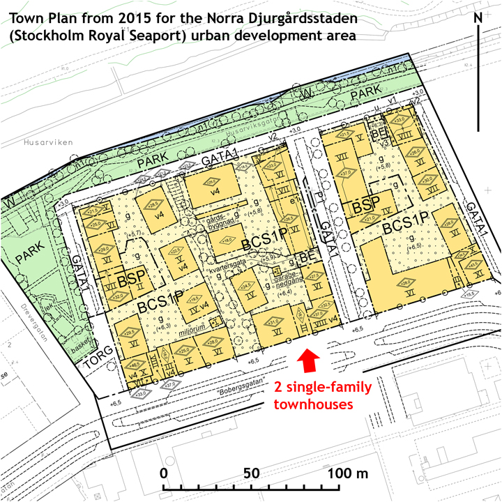
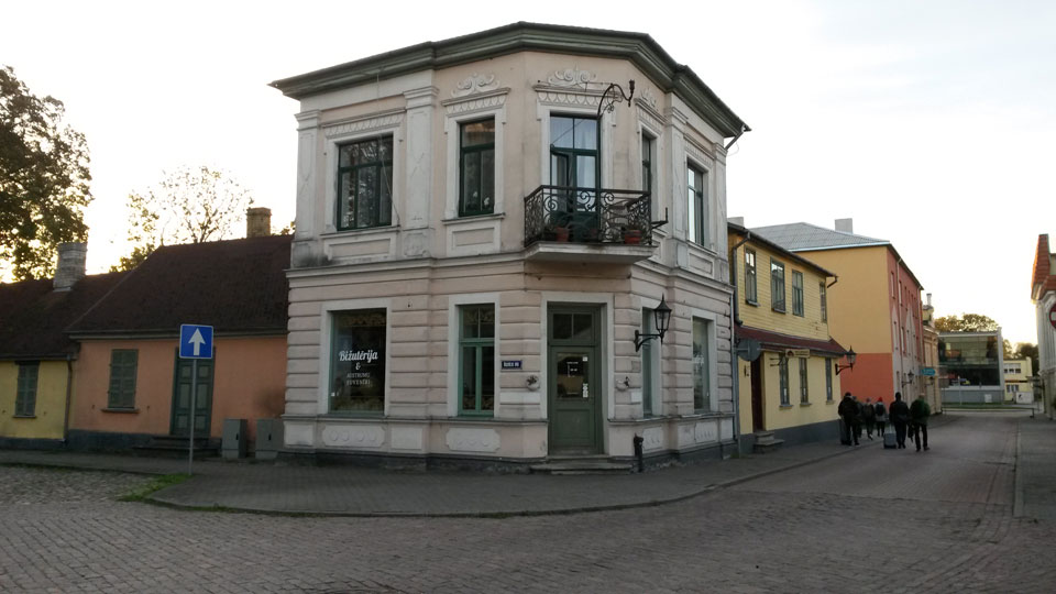
tiresome. Among everything that has been newly built there, only two single-family townhouses on Bobergsgatan (Boberg Street) are at all able to capture my genuine interest. These two single-family townhouses, standing shoulder-to-shoulder, are hands down the most interesting buildings of the entire housing development.
Take note! that—compared to everything else being built around them—both these townhouses exhibit a comparatively sober and toned-down type of modernism, and thus it is not the facade design of the townhouses, not the buildings’ facade materials or the balcony solutions: it is the property formation and the plot map at this particular location that makes this pair of townhouses so unique and interesting.
The Arbitrariness of it
When I first hear of the townhouse project on Bobergsgatan (perhaps two years ago), I of course ask myself how is it that Stockholm municipality right here, and only here, only in this place in the otherwise gigantic Stockholm Royal Seaport project, that the municipality finally experiments with property formation and plot map creation—instead of (as one otherwise always usually does these days) experimenting with facade design (and nothing else)?
But it turns out that it never was in fact really intended
to build townhouses here shoulder-to-shoulder, right next to conventional apartment buildings. No policy or politics with this goal was formulated from the authorities or politicians, it just turned out
this way, by accident or happenstance, and—given in my view the truly happy result—a fortunate happenstance in fact, a happy accident.
holesand
gapsin the row of buildings, has nothing of course to do with the project’s economic or technical conditions. The planner happens to like urban blocks with
holesin them, quite simply. In other words, there is a large measure of arbitrariness in this first phase of the planning.
2. But the politicians do not think the same way as the planner, the politicians do not want
gapsin the row of buildings on the block, they want to see a
tighter,more
urban-likebuilding formation along the new, wide Bobergsgatan—a street with boulevard ambitions. The City Planning Board therefore rejects the plan. Take note! that the politicians’ antipathies towards spaces between buildings,
holesand
gapsin the row of buildings along the block, has nothing of course to do with political leanings. Let us suppose that several board members happened to be sick that day and were temporarily replaced by alternates (certainly from the same parties as those who were sick, but at the same time with a completely different personal taste), then the whole thing could have ended in the opposite way, with the Board approving all the
holesin the plan. In other words, there is a large measure of happenstance and arbitrariness even in this phase.
3. The planner that got reprimanded certainly accepts that the plan now must be reworked, but seems unable to relinquish the idea of a looser silhouette along Bobergsgatan, and therefore makes sure to fill in the
holesand
gapsin the row of buildings with structures that are several floors lower than the surrounding buildings, and in doing so ensures that the row of buildings along Bobergsgatan still gives a looser impression. Imagine for a moment that another individual, another planner, with another personal taste, with a taste for what is easiest to handle and for the rational, had interpreted the Planning Board’s requirement for a more
urban-likeappearance by naturally creating a continuous row of buildings all with the same height along the street. The
brokensilhouette that instead now characterizes the reworked plan proposal, that silhouette is therefore also about the planner’s personal taste, not about necessity.
4. But before the reworked plan manages to get final approval from the Planning Commission, it happens that one of the municipality’s planners runs into his old friend Ola Andersson, an architect in private practice. The planner bemoans for his friend about how many of his colleagues at the Planning Department are fretting at this time over how one could possibly find a way to
fill up the holein the reworked plan for the Backåkra urban block. Does Ola have any ideas about what one can build in three floors in an eight-meter-wide plot? That is economically feasible at such a centrally placed and valuable plot of land?
5. Sometime later, during a meeting with representatives of the construction company Åke Sundvall, Ola brings up the question as he remembers it regarding the problematic eight-meter-wide building plot in the Backåkra urban block of the Stockholm Royal Seaport. Perhaps this little project would be of interest to Åke Sundvall? And Åke Sundvall is indeed interested. The Stockholm municipality is immediately contacted, and the builder announces their interest—which this company is unique in doing, since the project is probably too odd and unwieldy for any of the very large, extremely streamlined building companies.
6. Building rights for the eight-meter-wide and twenty-five-meter-deep former
gapis awarded to Åke Sundvall. This happens without any competition process; the Stockholm municipality is just happy that a builder is willing to take on the task of building on a plot with such odd conditions. Åke Sundvall then, in turn, commissions Ola Andersson to design the project.
7. Ola soon begins sketching up possible solutions. (In this phase—while the reworking of the development plan is still ongoing—Ola presents his sketches as part of a continual negotiation between the developer, the City Development Administration, and the Planning Department.) Student apartments perhaps? Four apartments per floor? Two small studios towards the street and two towards the courtyard on each floor? But in this case the Åke Sundvall company must get approval to build higher than what the project planner at the Planning Department had intended until now: an elevator in a three-story building is not particularly cost effective, especially in a building that is only eight meters wide. With more floors one could come up with a reasonable stair hall solution, and it is not too late for the city to change their minds regarding the number of floors, since the reworking of the development plan is still ongoing. But the project planner still insists on his beloved
gapand a maximum of three floors in the eight-meter-wide
hack.
8. Now (and not before), when the decision-makers at the Planning Department in the end refuse to accept more floors in the
gap,Ola Andersson does something that at first may seem counterintuitive: he tests the idea of dividing the plot into two even smaller, even
more troublesomeplots. It is an inspired exercise—since it turns out that two mutually independent four-meter-wide property strips, each containing its own three-story, eighteen-meter-deep townhouse (with no requirement for an elevator) is a more effective way to utilize the
troublesomebuilding rights than to, for example, shoehorn in a handful of narrow student apartments (which require an elevator). Said and done.
9. In the end, a development plan with two separate three-story buildings in
the gapis what is in fact approved by the Planning Commission, and it is Ola Andersson’s inspired whim to propose (not one, but) two properties in
the gapthat makes this part of the development plan at all possible to realize with any kind of reasonable economic feasibility. Which in turn results in a plot map that is easily the most interesting in the Stockholm Royal Seaport development area.1
Take note! that it is not the qualities of the townhouses but rather the qualities of the plot map that make the townhouse project in the Backåkra urban block seem so much more interesting than the other housing projects in the surrounding blocks. Inasmuch as both four-meter-wide townhouse plots are an expression of the kind of extremely rare, genuinely urban variation that characterizes cityscapes with strikingly high u-index values2 and clearly defined property lines, today one sees instead a superficial, forced variation that characterizes not only the artificially creative
new buildings in the immediate surroundings, but also in principle all the new buildings you see everywhere these days.
In this 4+4-meter-wide special case, arbitrariness and the course of happenstance lead overall to a fortunate result, a happy accident as mentioned earlier—but could have also just as well ended in a completely different and much less interesting result. If the Planning Commission had for example insisted on a more rational solution, for visual reasons if nothing else (in our times it seems that rationality for the most part is regarded as a question of personal taste
), then a street without hacks
and gaps,
without a variety of building heights, would have also been a rebuff of the revised development plan. And in that case, there would never have been any extremely narrow, four-meter-wide plots at Bobergsgatan, no interesting plot map, and no interesting townhouses.
But without arbitrariness and the course of happenstance, the Stockholm Planning Department on the other hand would never have succeeded in creating anything even half as interesting as the townhouse plots, which, as it turned out, just happened.
Consequently, it is in arbitrariness and the course of happenstance that an urbanity-sensitive property-line nerd like me must place all his hopes and all his trust these days.
Urbanity: What is it?
Be that as it may. The formation of an 8-meter-wide and 25-meter-deep plot shoehorned so to speak between two higher buildings in the Backåkra urban block, this introduction of ever more tightly spaced property lines in the urban block after the fact,
this change in the division of properties, as it turned out, had the effect of raising in one fell swoop the Urbanity Index u for the urban block from 0.78 to 0.85. And when this new, already unusually narrow plot later in the plan process is then split into two even narrower 4-meter-wide plots, the u-value is raised even a bit further, to 0.91. Not a huge increase, of course, but still an increase of great interest in principle: over the latest years I have over and over again, through a large number of examples (mostly in Stockholm and Gothenburg) argued that it is the u-value (the Urbanity Index u)—more than any other urban planning factor (much more than an exciting
and/or varied
facade design, for example)—that decides an urban area’s fate in the long perspective. The higher the u-value is, the better are the conditions for an economically dynamic and a socially and culturally favorable development of buildings and activities. This (certainly modest, but still noteworthy) increase of the u-value in the Backåkra urban block, from 0.78 to 0.91 in total, this u-value increase will in the long run have a much larger (positive) effect on Bobergsgatan’s claim to be a boulevard than all the form and color experiments found on the surrounding buildings.
How to Calculate the Urbanity Index u
The Urbanity Index of the Backåkra urban block is calculated as follows:
The sum of the lengths in meters of all the urban block’s inner
property lines (marked in blue in the adjacent illustration) = 36m + 25m + 9m + 45m + 27m + 40m + 76m + 31m + 51m + 25m + 4m + 4m + 25m + 25m = 423m.
The sum of the lengths in meters of all the urban block’s outer
property lines (marked in pink in the illustration) = 126m + 107m + 126m + 107m = 466m.
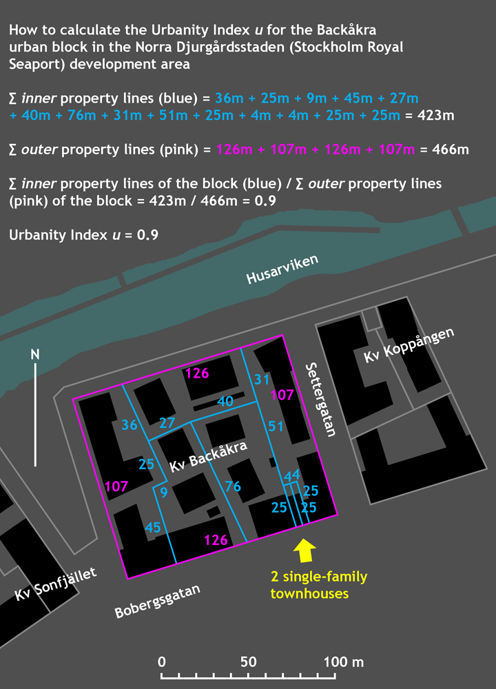
The Urbanity Index u for the Backåkra urban block is arrived at by dividing the sum of the lengths of the block’s inner
(blue) property lines by the sum of the lengths of the block’s outer
property lines: the Urbanity Index u = ∑property linesinner / ∑property linesouter = 423m / 466m = 0.91.
For the original, subsequently refused plan proposal (with a gaping hole
in the row of buildings), the total length of all of the block’s inner
property lines would have been 4m + 4m + 25m + 25m = 58m shorter than today, and the Urbanity Index u = 365m / 466m = 0.78.
For the later middle phase of the planning process (with new building rights in the hole,
but before deciding to split/divide the new building rights into two properties), the total length of all of the block’s inner
property lines would have been 25m shorter than today, and the Urbanity Index u would be 398m / 466m = 0.85.
Take note! that I usually state the u-value with one decimal. But in this case, when we are accounting for such small internal differences, we have a reason to make an exception and state the u-value with two decimals.
Take note! that all u-values over 0.5 should be regarded as acceptable when desiring a socially, culturally, and economically dynamic development, in other words a genuine urban development of building over time. And the higher the u-value, the better: in the urban environments that we all intuitively recognize and appreciate as especially socially, culturally, and economically dynamic, in other words genuinely urban, in these urban environments the u-value is always shown to be a bit over 1.0.
A Visit to the Site
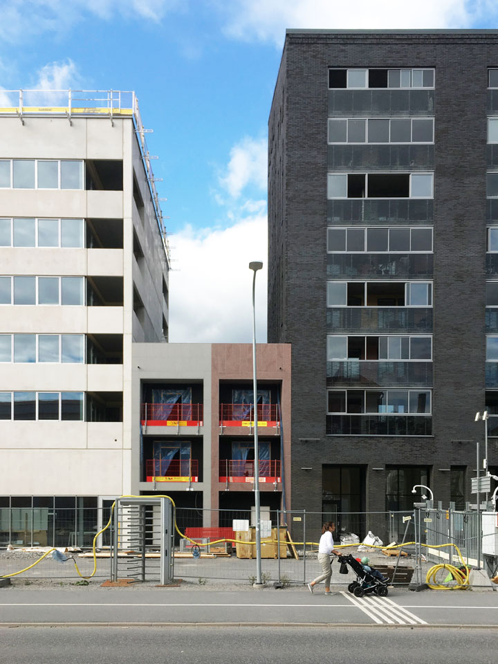
My very first visit to the site takes place in June 2019. I head out to Norra Djurgårdsstaden (the Royal Seaport) for one reason only, and that is to satisfy my curiosity about how far they have come along with the construction of the remarkable single-family townhouses that I had heard about through the grapevine. Upon arrival, I can see that nobody has moved in yet, but that the exterior is for the most part completed.
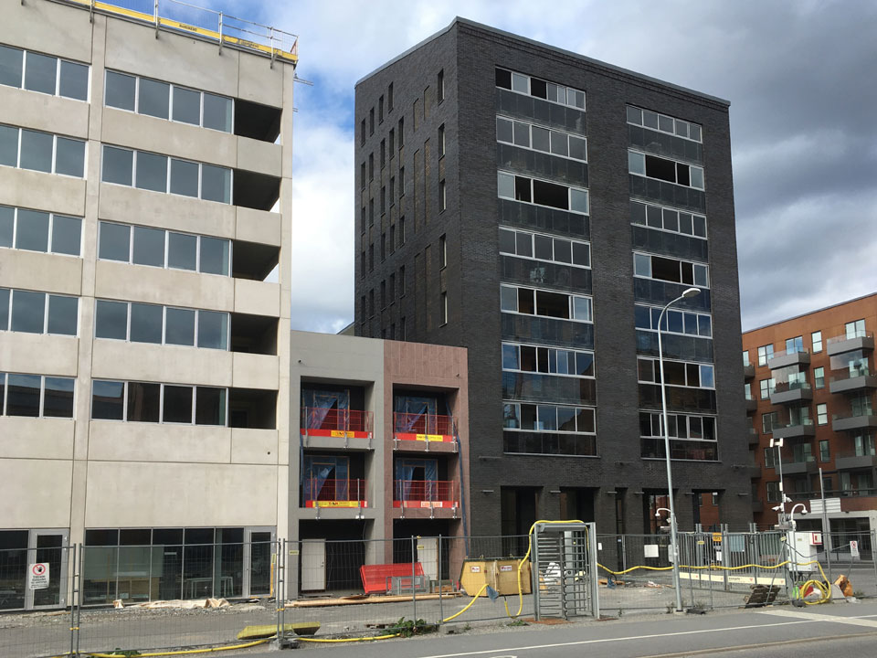
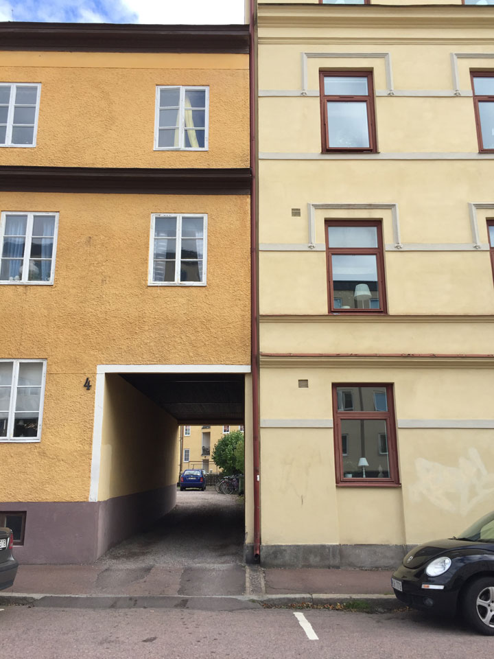
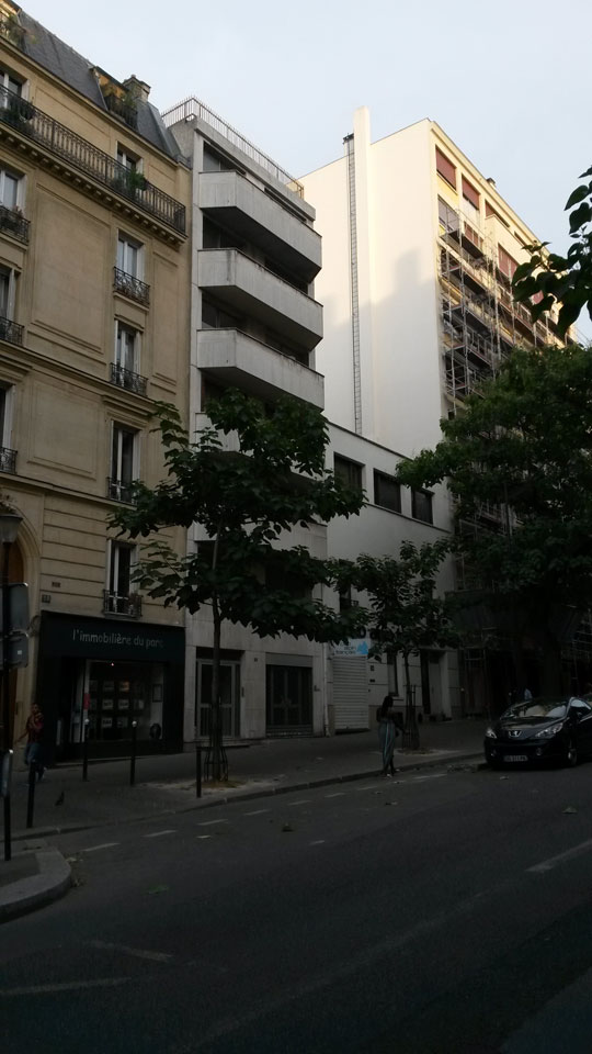
I note that one of the two flanking high apartment buildings (with the black brick facade) has holes for windows in the end wall/firewall at the property line that it shares with one of the townhouses. The other high apartment building (with a white concrete facade) also has holes in the end wall/firewall at the property line it shares with the other townhouse, in this case for recessed balconies. From all these holes for windows and balconies in the flanking higher apartment buildings’ end walls/firewalls, one therefore has direct views over the roofs of the townhouses, their roof decks, and their generous glass skylights. Which must naturally affect the privacy indoors, inside the townhouses: I guess that the clear glass of those skylights, which according to the information I received will be installed in both townhouses, will quickly be replaced by each owner with something that provides for more privacy—perhaps that brings in light but is not transparent, like opalescent or frosted glass.
Take note! that this is not a fault
on the part of the architect, it is in this case the planner who is to be faulted, who insisted on varying building heights along the same street (completely irrational), and at the same time allowed window-holes-in-the-property-line-towards-the-neighbor. If it had been a question of a firewall-in-the-property-line for real,
then no balcony or window holes in the end walls would have been allowed. The properties Backåkra 5 and 6 (the townhouse properties) would not have been subjected to direct views at angles from above.
Moreover, with the situation as it is now, if any of the townhouse owners in the future get the idea of building an addition to their four-meter-wide building with one or two or three floors, then that owner would run into problems, and problems not only with the regulations in the development plan regarding the building heights: the owners of the neighboring property will in all likelihood oppose and appeal every change to the development plan; they of course do not want to have their windows or recessed balconies in the end wall blocked by higher buildings on the adjacent properties.

And look here, another unconventional solution in the end-wall-at-the-property-line: notice how the eight-story high apartment building (with the black brick facade) extends out a bit, out over the adjacent townhouse, infringes (with facade brick and insulation, 30 centimeters or so) over the adjacent townhouse’s plot. This was unexpected! (Compare with the other flanking apartment building, clad in white concrete—its outer wall at the property line is completely vertical, does not infringe at all in the nearest townhouse’s air space, keeps to its own property line, not only near the ground but all the way up to the roofline. This is how things usually look, how one usually builds.)
But this extended black brick facade is a solution that was carried out with the approval of the townhouse architect, a pragmatic solution that was arrived at through negotiation, that the architect of the townhouses himself agreed upon, and is not in principle opposed to, as I later learned. And in its way, this is a fully rational solution: bearing walls may be placed right at the property line, and the part of the bearing wall that has no neighboring wall built directly against it, and is therefore exposed to the weather and wind, it needs to be clad—with the neighbor’s permission—with extended (and infringing) insulation and facade brick.
But this technically pragmatic solution is predicated on cooperation and negotiation across the property line in question, between the property owners. And sometimes close neighbors in fact come into disagreement, at times close neighbors oppose each other.3 Therefore this infringement
on the neighbor’s plot—even though perfectly rational from a technical point of view, even if it is only 30 centimeters—is at the end of the day a barrier to a truly amenable, friction-free, and dynamic property development in the future. The extended facade brick plus the window holes at the property line towards the neighbor certainly are not unsurmountable barriers, but regarded as barriers they are both unnecessarily expensive and cumbersome to get around when the time comes to begin to renew/refine/densify in the urban block. Because buildings in real
cities continually change. Because real
cities are not completely static phenomena.
Appendix 1 of 2. Photo: Lars Marcus
As a direct consequence of, and a direct response to my work with the above article, Lars Marcus (as a part of an ongoing informal text message and email conversation between Lars Marcus, Johan Johansson, and myself) e-mailed a photograph to Johan Johansson and me that he took in Rome 2015 and wrote the following comments. In his e-mail from September 12, 2019, Lars Marcus discusses plot boundaries and property formation from an historic perspective:
Extorquere possessoribus proximas domos
A telling expression of the power of property lines can still be seen today amongst the ruins of ancient Rome. When the city was growing, Julius Caesar took the initiative to expand the Roman Forum, the central meeting place of republican Rome, with a new forum named after himself, which clearly indicates the shift from a republic to an empire that Rome underwent at that time. After the murder of Caesar, when Caesar’s adoptive son Augustus together with Marcus Antonius assumed power through the battle of Philippi, Augustus promised to give the city another forum. Augustus was not fully in power, however, and he understood early on the need to proceed carefully. When he failed in acquiring the properties that were needed to fully realize the grand plans for his forum, he decided to back off.
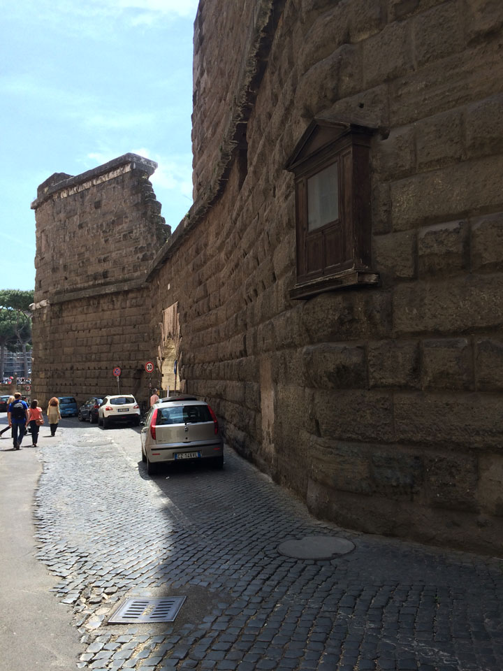
The effect of this is visible even today when walking down via Tor de’ Conti. Here one finds a tall firewall that protects Augustus’ forum from the districts in the northeast, which during the ancient era were known as Subura. The wall was originally 36 meters high, so here there was no lack of resources. Despite this, the wall changes directions in a couple of places where Augustus did not own the land, thereby infringing upon the ideal rectangular form of the forum complex. It is carried out well, so one would not really have noticed this from within the forum, but the fact remains: not even the Caesar of Rome could unabatedly do as he pleased with the property lines of his neighbors.
The important source of our knowledge about this is from Suetonius in his biography Lives of the Caesars, where he refers to Augustus: Forum augustius fecit non ausus extorquere possessoribus proximas domos, or in English: He made his forum narrower than he had planned, because he did not venture to eject the owners of the neighboring houses.
4
Appendix 2 of 2. Photos: Johan Johansson
As a direct consequence of, and a direct response to all of my articles about the concept Urbanity Index
in recent years, Johan Johansson (as a part of an ongoing informal text message and e-mail conversation between Johan Johansson, Lars Marcus, and myself) has since 2016 from time to time e-mailed or texted photographs from his many travels, photographs from urban environments with strikingly high u-values, photographs that I have compiled for this appendix with Johan’s permission.
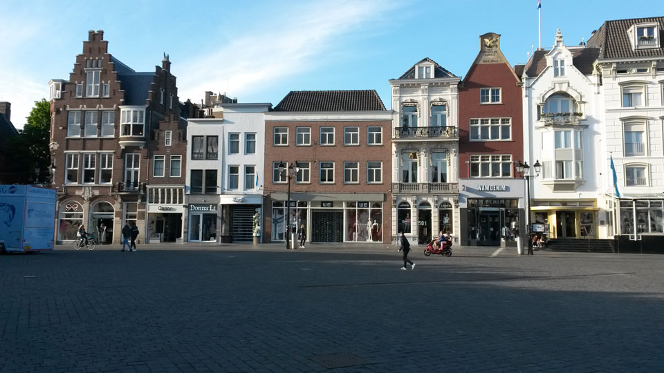
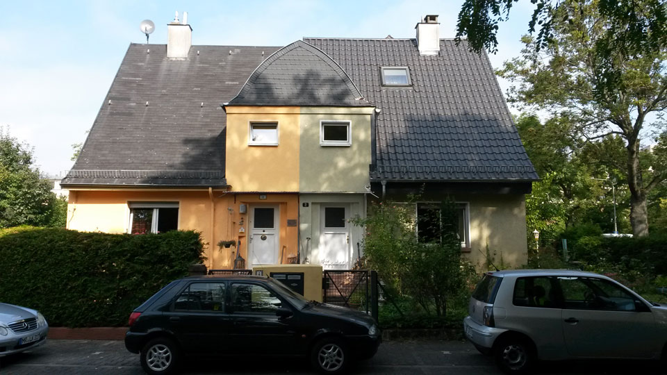
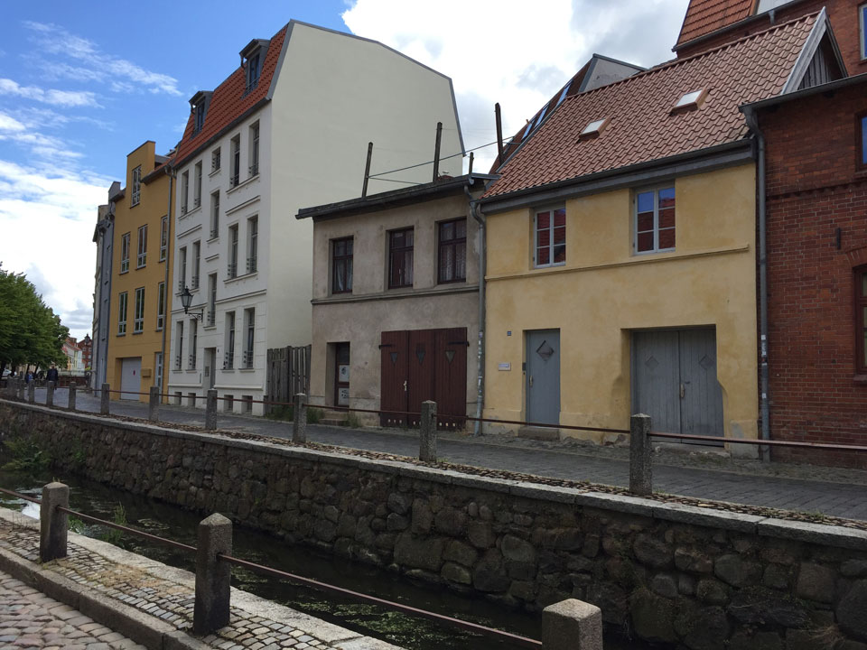
The Urbanity Index u has incidentally over time become a concept that Johan uses often in his emails to Lars Marcus and me, in his everyday prose, in his spontaneous descriptions of specific urban environments—as in the following comments in his email to Lars Marcus and me from July 10, 2019 about the u-value in the north German town of Wismar apropos some of the photographs that are included in my selection for this appendix:
The small prosperous town Wismar is interesting in several ways, not least because the u-value is probably amongst the highest in Europe, despite twelve years of Nazism, four years of Soviet occupation, and forty years of Communist dictatorship. In the old town center, it is said that there are over 1700 private properties today, despite several aggregations for administrative buildings, large hotels, department stores, etc. Even apartment buildings from the Communist era are built with firewalls at the property lines, and there are several relatively new apartment buildings that are on small properties with facade lengths of between six and twenty meters, see the attached photographs.
We see in this very short comment to Johan’s own photographs how the concept Urbanity Index has saved time and energy and space for the author: without direct allusion to a u-value, the description would have needed to be much, much longer, and Johan’s reasoning would moreover had come across as inexact. The concept Urbanity Index immediately puts a finger on what Johan regards to be most important in the context of what is discussed.
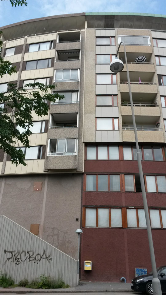
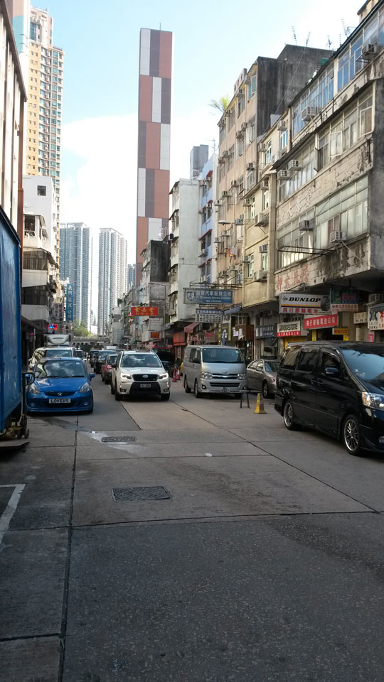
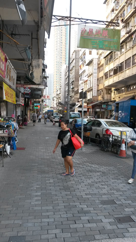
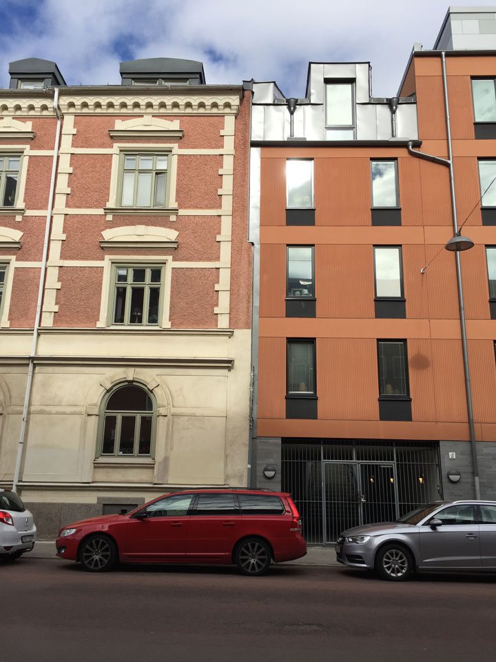
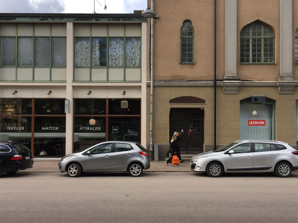
What follows is 25 of Johan Johansson’s examples (from four continents) of urban environments with strikingly high u-values:


Happy Accident) together with the above appendices in the architecture journal Kritik, Stockholm, Sweden, no. 42/43-November 2019.
Happy Accident (svenska)
The Urbanity Index u
urbanitythan, for example, the floor area ratio FAR. A list of links to all articles in this series:
About the Urbanity Index u
Illustrations
• The current development plan (from 2015) for the Backåkra and Koppånger urban blocks, Stockholm Royal Seaport development area. Image source: Stockholm Municipality. Montage: Mikael Askergren (2019).
• Property line map with u-value calculations for the Backåkra urban block, Stockholm Royal Seaport development area. Montage: Mikael Askergren (2019).
• New buildings on Bobergsgatan, the Backåkra urban block, Stockholm Royal Seaport development area. Detail. Photo and montage: Mikael Askergren (2019).
• Rome, Italy, via Tor de’ Conti. Photo: Lars Marcus (2015).
• Twenty-five examples from four continents of urban environments with strikingly high u-values. Photos: Johan Johansson (2013-2019).
Footnotes
Urbanity: What is it? Or How to Calculate the Urbanity Index u,published in Swedish in the architecture journal Kritik, Stockholm, no. 32-December 2016;
Ask for Kenneth,published in Swedish in Kritik, no. 37-July 2018.
Ideology Theater,published in Swedish in the architecture journal Kritik, no. 38/39-December 2018;
Good Fences Make Good Neighbors,published in Swedish in Kritik, no. 41-August 2019.